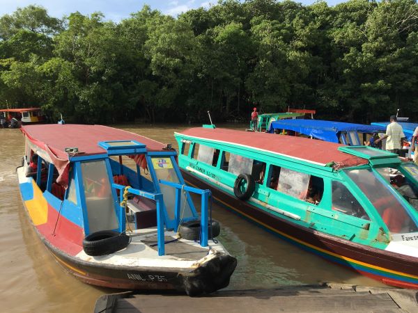
Essequibo River water taxis. Photo by Joe Yogerst.
Guyana is becoming world-renowned for its natural treasures. But the rapidly emerging South American destination boasts some pretty cool historic sights, too. Like Fort Zeelandia on the Essequibo River.
The 17th-century citadel is located on Fort Island, where the modern history of Guyana began around 400 years ago (1616) when the Dutch established the Essequibo Colony, a small foothold at the top end of South America.
It was apparently a lively little colony, populated by soldiers, administrators and civilian settlers who grew cotton, cacao, indigo and other tropical crops in the rich alluvial soil. They also traded with the local indigenous people and another Dutch colony called Demerara that eventually evolved into Georgetown.
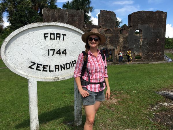
Photo by Joe Yogerst.
Seeking better defense against pirates, Amerindian raids and rival European empires, the Dutch West India Company funded the construction of Fort Zeelandia in the 1740s using slave labor. The bastion protected the remote colony for nearly 200 years — until it finally fell to Britain during the Napoleonic Wars.
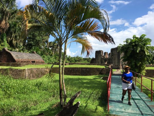
The Armory (left) and Main Redoubt at Fort Zeelandia. Photo by Joe Yogerst.
Featuring a lozenge-shaped two story redoubt surrounded by earthen ramparts, the fort ruins overlook the Essequibo River on the north side of Fort Island town. A couple of antique Dutch canyons and an armory with an arched-barrel roof round out the military complex.
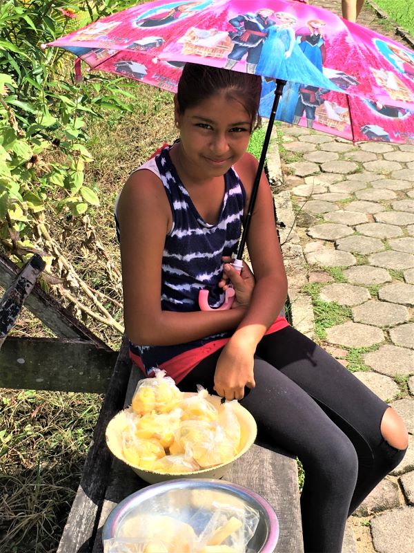
Villagers sell snacks along the island’s waterfront path. Photo by Joe Yogerst.
From Fort Zeelandia, a walkway runs the length of the village to the floating dock that brings visitors from the mainland in water taxis and private sightseeing boats. On weekends, many of the 70 or so people who still reside on Fort Island are out in force, selling tamarind balls, coconut water and other treats along the path.
The island’s other historic gem lies at the south end of the village — the Court of Policy building, which did triple duty as a courthouse, administrative building and Dutch Reform Church during colonial times. It’s also believed that slaves were sold there.
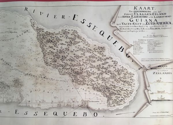
Old Dutch map of Fort Island in the Court of Policy Museum. Photo by Joe Yogerst.
Nowadays, the resurrected structure (restored in 2000 by the Guyana National Trust) houses a museum detailing the history of Fort Island and 300 years of Dutch colonization along the north shore of South America. Among the collection highlights are marvelous old maps of Guyana and old Dutch tombstones.
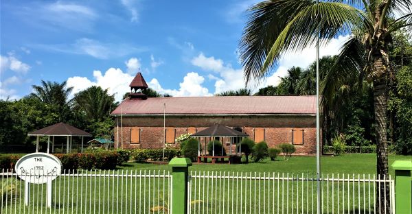
Restored Court of Policy. Photo by Joe Yogerst.
Georgetown-based tour operators like Evergreen Adventures run excursions to Fort Island. Day trips start with a drive across the Demerara Harbour Bridge — the world’s third longest floating bridge — and then along the north coast to Parika.
The big wooden stelling (dock) in Partika is the departure point for the large vehicle ferries and smaller tour boats that ply the Essequibo. Which, by the way, is the biggest river along the South American coast between the Amazon and the Orinoco.
Many of the day trips include lunch and a chance to swim at riverside resorts like Baganara Island, a stroll through colorful Bartica Market, and a slow-float past Mazaruni Prison.